Human development gobbles up hundreds of miles of western land each year

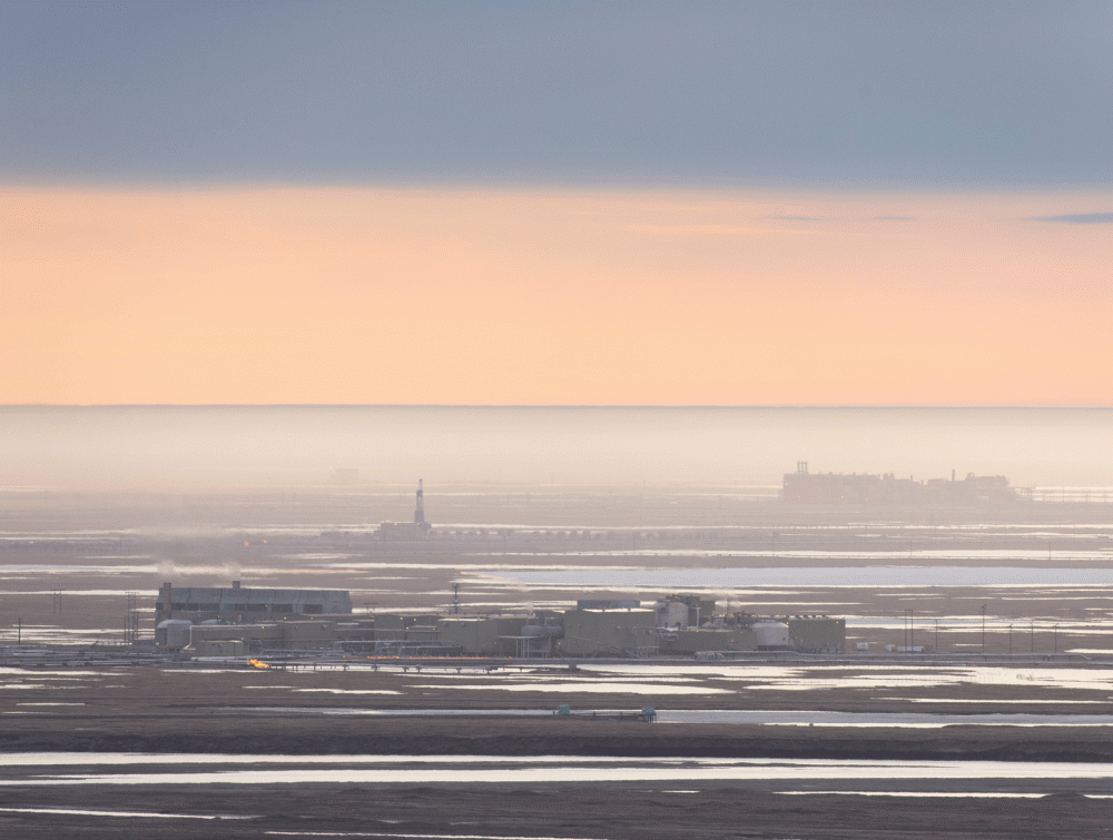
Development in Alaska.
Florian Schulz.
The wild land in the American West being overtaken by development
New research illustrates how much wild land in the American West is being overtaken by development.
Development from mining to urban sprawl already covers about 165,000 square miles of natural area in western states—and it claimed nearly a football field worth of new land every few minutes between the years 2001 and 2011.
These numbers come from a report released by the non-profit Center for American Progress and Conservation Science Partners that measures the footprint of human activity in the 11 westernmost states in the continental U.S. (Arizona, California, Colorado, Idaho, Montana, Nevada, New Mexico, Oregon, Utah, Washington and Wyoming) over the course of a single decade.
See the interactive map
The report concludes that between 2001 and 2011, western states "lost" a total of more than 4,300 square miles to urban sprawl, energy development, transportation, agriculture, timber harvesting and other human activity—a dark trend at a time when public lands are threatened by a radical "land takeover" movement.
Researchers also found that only 12 percent of lands in the surveyed states are permanently protected so as to retain their natural qualities, lagging behind a joint U.S. and Canadian goal of 17 percent by the year 2020. Furthermore, not even land administered by federal agencies like the U.S. Forest Service or Bureau of Land Management is safe: lands modified by human development under that status went up by nearly two percent.
All this development is taking a toll on wildlife habitat, which is being sliced into fragments that make it difficult for animals to get where they need to go. This, coupled with expected changes in climate, has increased the importance of migration corridors that connect protected areas, as discussed in recent research from The Wilderness Society and other organizations that identifies the wildest corridors in the contiguous U.S.
How the West was lost
The findings highlight four types of human activity, or "stressors":
Urban sprawl covers industrial, commercial and residential development, and was responsible for the loss of 2,343 square miles of natural areas in the period studied. California lost 811 square miles to urban sprawl, and Arizona lost 367 square miles—the latter a 30.6 percent increase.
Energy covers production and mining from a variety of sources, including oil and gas wells, coal mines, quarries and wind turbine farms. Utah (39.5 percent), Wyoming (38 percent) and Colorado (32.8 percent) saw major spikes in the percentage of their natural land covered by energy development.
Agriculture/Logging has the largest physical footprint across the West, covering at least 5,000 square miles in each state studied. Between 2001 and 2011, Oregon lost 97 square miles to timber harvest or agriculture, a 1.2 percent increase.
Transportation refers to everything from highways to railroads to power line infrastructure, and the lands most heavily modified by it are predictably clustered around major metropolitan areas.
What we can do to help
We must do all we can to prevent our wildest lands from falling prey to development. Right now, a fringe movement is gaining steam with the aim of seizing public lands like national forests for state control, whereupon they may be sold off to commercial interests or otherwise managed in a way that cuts off public access to cherished outdoor recreation spots.


