Maps show how Trump admin chose oil, gas and coal over important fossils in Grand Staircase-Escalante

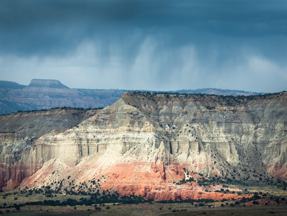
Grand Staircase-Escalante National Monument, UT.
Mason Cummings, TWS
Unlawful cuts to Grand Staircase-Escalante National Monument prioritized drilling and mining over science.
New Wilderness Society maps show that the unlawful cuts the Trump administration made to Utah’s Grand Staircase-Escalante National Monument paved the way for coal, oil, gas and tar sand development in many areas that have enormous potential for fossil finds that could advance scientific understanding of how species evolved.
The maps, based on the Bureau of Land Management’s (BLM) own data, show that many of the areas most directly threatened by energy development overlap with fossil resources that are among the best in the world.
The map below shows the areas of high and very high “fossil yield potential” that overlap with energy development areas. Nearly half (46 percent) of the lands eliminated from Grand Staircase-Escalante National Monument have high or very high fossil potential, and nearly 250,000 acres of these lands directly conflict with energy development areas.

High fossil yield areas threatened by energy development in Grand Staircase-Escalante National Monument, Utah
The Wilderness Society
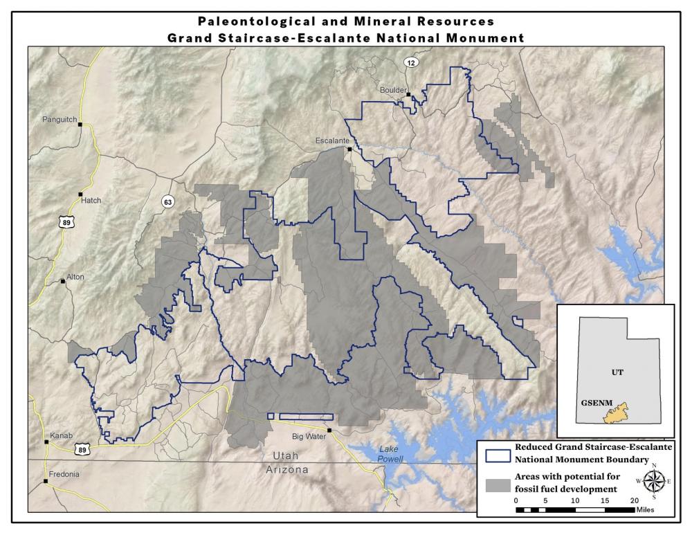
Below is a map showing the energy development potential areas within the original boundary of Grand Staircase-Escalante National Monument compared to the drastically reduced boundaries. It indicates that in many areas, the boundaries were drawn almost exactly along the lines of energy development areas eyed by industry.

Areas with fossil fuel potential and the reduced boundaries of Grand Staircase-Escalante National Monument, Utah
The Wilderness Society
More than 700 scientifically important fossil sites have been excluded in the new monument boundaries, while researchers still have decades of work to be done to survey the full monument.
Grand Staircase-Escalante isn’t the only national monument facing threats to paleontological resources. A unique and scientifically important cache of Phytosaurs, crocodile-like reptiles, was found on lands eliminated from Bears Ears National Monument and looting concerns have arisen.
Why does energy development threaten fossil discoveries?
The link between energy resources and fossils is no coincidence, there is a reason they are called fossil fuels. The coal resources were originally ancient swamps in which early mammals, lizards, and dinosaurs lived, leaving behind their imprints in the fossils we find today. Similarly, uranium is found in ancient river beds in which fossils of the ancestors of dinosaurs and mammals are found.
Since fossils are found in exactly the geologic layers in which coal and uranium are found, mining processes would almost certainly destroy fossil sites. Similarly, oil and gas techniques pose major risks as well. For example, some of the most vulnerable fossils are those in the Tropic Shale, which has remains of an ancient ocean with many giant marine reptiles. If the Tropic Shale were fracked, it would destroy fossils throughout the entire formation.
While the BLM does have requirements for some paleontological surveys and environmental reviews prior to development, these can often be rushed and inadequate. The BLM staff doesn’t always have paleontological experts available for every survey and the current Administration’s effort to radically reduce environmental reviews increases the likelihood that any review would miss important fossil finds. It also rules out advances in technology – for example, the BLM may largely rely on analyses of sites from prior to 2009 and leading paleontologists use technology and techniques which have greatly improved in the past decade.
How important is the monument to science?
Even the BLM refers to Grand Staircase-Escalante as the “Science Monument” for its incredible fossil resources. Earlier this year, Sec. Zinke shared a picture of a Lythronax skull(a relative of the T-Rex known as the “King of Gore”) that he keeps in his office. He failed to reveal that the skull and species discovery originated within Grand Staircase-Escalante National Monument at a site that is right on the border of the redrawn boundaries.
According to the Society for Vertebrate Paleontology, hundreds of fossil sites have been excluded from GSENM. This includes a section that has by far the best record in the world of land animals from the Cenomanian age, which is an important interval in the Cretaceous period from 100.5 to 93.9 million years ago when mammals were diversifying into the groups we now recognize as marsupials (the pouched mammals) and placentals. Almost all the evidence we have for the species that existed on land at that time are from a few sites on lands that are now excluded from the national monument – risking our ability to advance our understanding of mammalian evolution.
In addition to Lythronax and the Cenomanian mammals, the lands which were removed also include the site where the dinosaur Machairoceratopswas discovered.
Our full analysis
Mapping
Data – All data was compiled from BLM’s GSENM DEIS database
- Potential Fossil Yield- Predictive resource management tool developed by the BLM to classify geologic units on their likelihood to contain paleontological resources on a scale of 1 (very low potential) to 5 (very high potential). We depicted areas on the maps containing high (category 4) or very high (category 5) potential for fossil yield. These categories require surveys and monitoring for any surface-disturbing mineral activities.
- Known Recoverable Coal Resource Area - Existing coal fields within the monument.
- Tar Sand Areas - Tar sand deposit areas within the monument.
- Oil and gas high potential areas - Oil and gas plays within the monument currently producing oil and gas or having high current industry interest.
Analysis
We identified areas of high / very high potential fossil yield within the original monument and calculated the acreage of these paleontologically rich areas that were removed from the monument following the reduction. We then combined areas identified by BLM to contain developable fossil fuel resources (tar sands, known recoverable coal resource area, oil and gas high potential areas). We calculated the overlap of the fossil fuel development areas with the areas of high / very high potential fossil yield within leasable areas of the monument. Leasable areas are areas open to leasing in the Draft Monument Management Plan alternatives.
Results
- Approximately 46% (406,000 acres) of the areas cut out of the original monument show high or very high potential fossil yield.
- 245,708 acres of areas of high / very high potential fossil yield are threatened by energy development and identified by BLM as being potentially open to future leasing.
To download detailed maps of our findings, click the links below.
