New tool spotlights wildest places across contiguous U.S.

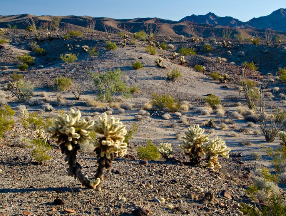
The wild beauty of Chuckwalla Bench, part of the California Desert National Conservation Lands
Sam Roberts
The Wilderness Society’s new ‘Find Wildness' map affirms need for urgent protections as human footprint expands
A new tool developed by The Wilderness Society maps the wildest places across the contiguous United States, revealing places furthest from roads where nature is relatively intact, the night sky is dark, and nature’s sounds are not drowned out by traffic or other industrial noises.
The launch of the tool comes at the end of Wilderness Month – a celebration marking the 60th anniversary of the Wilderness Act. The landmark law empowered ordinary people to protect wild places on federal lands through their elected representatives in Congress. Today designated wilderness areas, national parks, national monuments, and national wildlife refuges protect land across the country, safeguarding critical habitat, clean air and water, invaluable cultural sites and spaces for outdoor recreation -- and while that is a massive achievement, the vast majority of wild spaces remain unprotected.
The tool localizes ‘wildness’ down to individual counties, revealing that these special places exist beyond just the American west. Wild places sustain benefits for local communities, whether it be filtering through clean air and water and providing unique recreational opportunities. Simply acknowledging where these relatively wild places are, connects the public to the values that The Wilderness Society hopes to sustain on federal public lands and fuels support for the international goal of protecting 30 percent of the world’s lands, fresh waters, and oceans by 2030.
“Analyzing the data to identify the relatively wild places in every state and county highlights the values the Wilderness Act sought to protect – wildlife habitat, air quality, water quality, scenery, recreation – and celebrates how these values exist across the country and near every community.” said Travis Belote, senior science director for The Wilderness Society. “It is our hope that as we celebrate 60 years of the Wilderness Act, this tool empowers communities across the country to discover, support and protect those wild lands and waters near them.”
While wilderness is a location of land, wild-ness is a relative quality of land. The analysis and interactive map was led by scientists of The Wilderness Society working with Gage Cartographics and a new national dataset of ecological intactness produced by Dr. David Theobald of Conservation Planning Technologies. Theobald used data on land use, roads, light pollution, human population density and other features to map an index of ecological intactness, a proxy for wildness.
Local efforts to protect some of the wildest places in the country, highlighted in the map, are already well underway:
Example 1: Chuckwalla National Monument effort and Joshua Tree National Park expansion
The proposed Chuckwalla National Monument and Joshua Tree National Park expansion aims to preserve approximately 627,000 acres of vast California Desert ecosystems and habitat intact for species like the Chuckwalla lizard and desert tortoise and safeguard migration corridors for desert bighorn sheep. Located south of Joshua Tree National Park and north of the Chocolate Mountains, the proposed monument stretches through the wild public lands primarily situated south of Interstate 10 and is easily accessible to eastern Coachella Valley residents and other local communities.
Example 2: Proposed Great Bend of the Gila National Monument
In south-central Arizona, nestled between the cities of Phoenix and Yuma, lies a stretch of river valley and surrounding desert known as the Great Bend of the Gila. This classic Sonoran Desert landscape ranks first in biodiversity among the deserts of the U.S. It serves as a vital core habitat for species such as the endangered Sonoran pronghorn, mule deer, Desert bighorn sheep, and others. Due to its proximity to the Phoenix metro area, the Great Bend of the Gila is also a place where local communities can explore, hike, camp, and hunt. Designating the Great Bend of the Gila as a national monument would safeguard these recreation opportunities, create economic opportunities for local and regional gateway businesses, and preserve a biodiversity hotspot.
For more information about the ‘Find Wildness’ tool or to be connected to our scientists, contact Emily Denny, Communications Manager, edenny@tws.org
